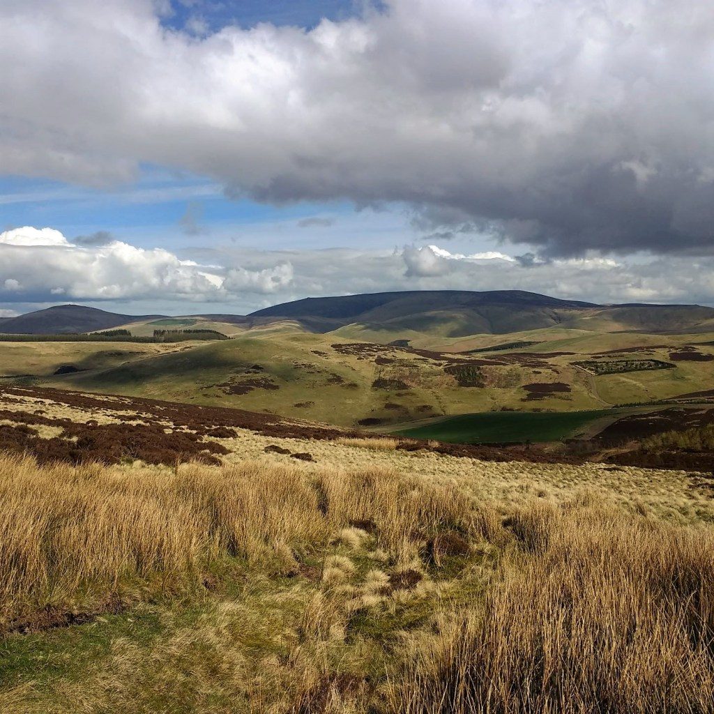
Stunning Walk in the Cheviots
It was a sunny and (relatively) warm Easter Monday when we set out on this walk in the Cheviots, exploring the Scottish side of the range. Whilst the OS map of the English side is riddled with rights of way, these indications of routes stop once you get to the Scottish border. The general right to roam meaning that marked rights of way are not necessary. So, although there are apparent roads and paths on the map, they are not always easy to find or actually passable. This is perhaps one of the reasons why this part of the Cheviots feels so remote.
Start at Belford
We headed up through Yetholm (with the end of the Pennine Way and St Cuthberts Way going through it this is where you DO see walkers) and past Primside Mill on a road signed to Belford and Sourhope. This no-through road follows Bowmont Water, a very pretty tributary of the Tweed. Just past the hamlet of Belford there are wide grass verges next to this river, the perfect place for a bank holiday picnic. Had this been in the Lake District it would have been heaving, as it was we had it to ourselves.
To start our walk we headed slightly further up the road and took the old tarmacked road on the right next to a monkey puzzle tree. This was an easy route to the farm at Calroust, indeed it was probably the old road to the farm, the newer route to the east has not yet made it on to my map. A wheatear was the first summer visitor I spotted on the wall alongside the path. As you approach the farm you can see the path you will be following heading towards Mossy Law to the South.
Calroust Burn
Follow this road through the farmyard and keep on walking up the very good track. It was lovely to hear that the willow warblers had arrived, joining the chiffchaffs and wrens in what bit of woodland there was. The route follows the Calroust Burn up the valley and past a couple of either fishing or shooting ponds. Eventually you get to a remote cottage, Calroust Hopehead. We sat down and had our lunch here, enjoying splendid views down the valley across to the Lammermuir Hills in the north.
We were sitting by the burn for our break and had already seen that there was frogspawn in it, so I had a little “guddle” to see what else was in the burn – it was quite slow flowing at this point as it was just upstream from a small ford. I soon spotted tadpoles, pond skaters, caddis fly larvae and mayfly larvae so a very busy little bit of water.
Reaching The Street
At this point we decided to do a loop round and pick up The Street, an ancient route through the hills joining Coquetdale in the South with Hownam and Morebattle to the north, probably as a drover’s road. At this point the path was not so clear – we branched right on a track that had been recently cleared that took us round a small plantation. With no path ahead we could see a gate with what appeared to be a good path beyond it, so headed across the heath with few problems picking sheep paths where we could. Going through the gate we were soon on this good path – the Street.
We joined it just a few hundred metres into Scotland. It was marked on a map in 1543 as one of the formal crossing points between England and Scotland and it must have been a very good route. It was relatively flat and covered in short grass, making it easy and pleasant walking. I was still buzzing from the previous day's hill run, so I was also imagining how lovely it would be to run this route. It also gave us spectacular views over to The Cheviot itself to the south-east and across to The Eildons in the west.
Bird song
Normally these uplands are rather denuded of wildlife, but on a lovely spring day it was full of bird song, most noticeably skylarks and meadow pipits. There were also curlews and red grouse although no cuckoos, which I am sure will be returning to these uplands any time.
To complete this route, I would recommend that you follow The Street across a large field, Calroust Common, over the top of Murder Cleugh and then follow the newly cut track to your right and back down to the farm, returning the same way as you came. You will have seen this track on your way up the valley even though it is not on the map.
We decided to go a bit further and try to pick up where The Street meets Belford Hope. Unfortunately we didn’t stay on The Street far enough and picked up another track which took us to the trig point on Craik Moor. We then followed the wall downhill and into another very large and steep field which we walked down keeping our eye on Belford and the road for navigation. We came out by the monkey puzzle tree and then back to the car where we had another brew-up before going home.
Stunning views
This walk was so much better than we envisaged, with plenty of wildlife and stunning views. For the entire duration of the walk we someone cutting the lawn at Calroust and a farmer and his dog, so no walkers, runners, mountain bikers or horse riders despite it being a lovely bank holiday. It really did feel off the beaten track and we can’t wait to explore further.


Distance: 12 km
Climb: 300 m
Difficulty: Medium
Navigation: Medium
Date walked: 18th April 2022
- wheatear
- skylark
- meadow pipit
- frogspawn
- caddis fly larvae

